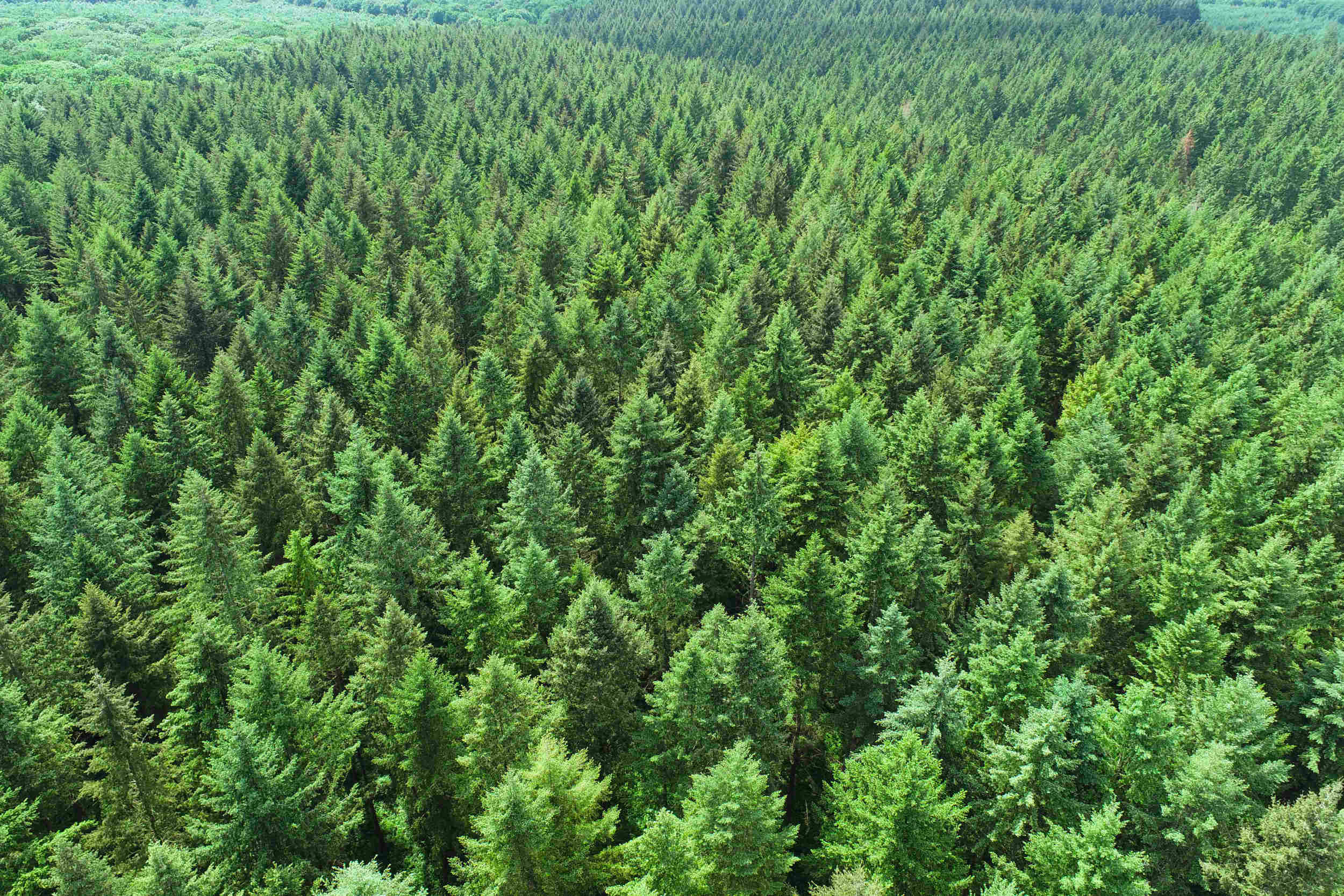
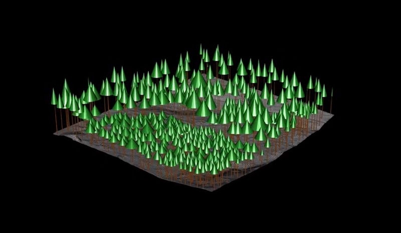
Model your forests in 3D and conduct a forest inventory
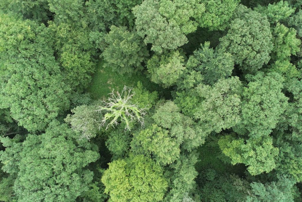
The drone equipped with a lidar (laser scanner) allows you to quickly digitize a forest.
The benefits of drone in the forest
- Make a forest inventory (counting, height, diameter, petrol, etc.)
- Calculate the amount of sequestrated carbon (carbon and CO2)
- Help with forest management via a canopy height map
- Identify the decoussing trees via multispectral imaging
- Restore wetlands via an analysis of hydrographic networks
- Plan the movement of forest vehicles via a topographic model
- Prevent fires through the production of a combustibility card
- Estimate the damage following a storm or fire
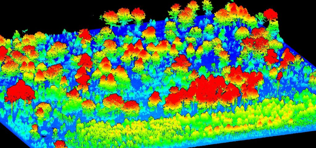
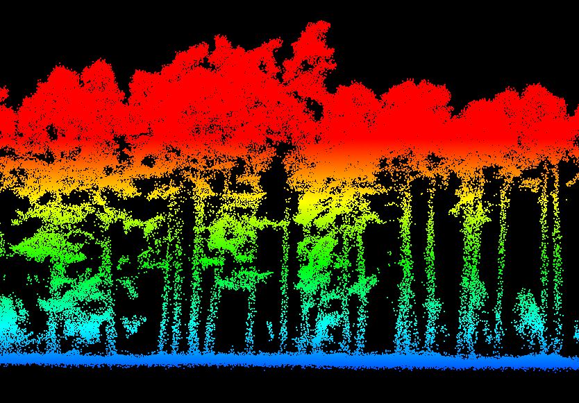
Use the Lidar to analyze your forests
The Lidar sensor is a moving scanner and therefore works on the laser principle. The laser rays allow you to cross the canopy of a forest and have information at the level of the soil and the structure of the trees. Once digitized, the forest model is treated algorithmic in order to determine key information to the production of a forest inventory.
High definition mapping for advanced analyzes
Take advantage of a quick deployment and time saving thanks to the flexibility of the drone and the automation of the missions.
Data acquisition (lidar, photo, multispectral, satellite)
We use the sensors adapted to your need. We can for example coupled the LIDAR with photogrammetry to restore both an MNT and a high resolution speech theography.
Learn more
Production of cards (canopy height, settlement density, etc.)
The LIDAR statement allows us to produce the different cards useful for forest management. This cartography makes it possible in particular to better understand the distribution by height, by density, by volume or petrol.
Learn more
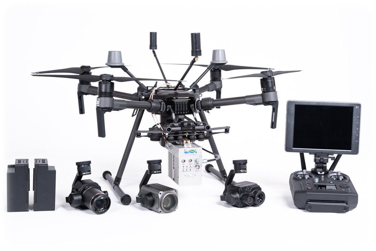
Scanforest offers a new solution and a unique methodology adapted to the needs of forest managers
The DJI drones of the Matrix range and the Lidar Liair V of Greenvalley guarantee a specific data acquisition while providing rapid deployment.
Equipment adapted to precise data collection
The DJI matrix 210 drone equipped with a Lidar is able to carry out complex data collection missions intended for surveying, forestry, hydrology, environmental study, mining, development of the development territory or archeology.
With its 3 echoes, the Lidar Liair V scans 100,000 points per second up to 260 meters away.
A lidar with an ultra-efficient Livox Mid-40 head
The MID-40 sensor uses an advanced non-repetitive scanning model to provide very precise details in the field of vision.
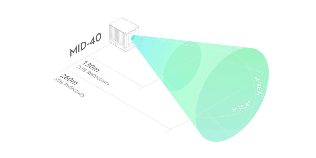
A sampling rate of 100,000 points per second
A circular field of vision of 38.4 °
Detection of objects within a radius of 260 meters
IT tools adapted to the processing of forest data
Our proprietary software, specialized in the processing of photo data, Lidar and multispectral, allow us to perform tailor-made treatments adapted to your plots (hardwood and resinous)
Lidar data acquisition, photos, multispectrals ...
We use the sensors adapted to your need. We can for example coupled the LIDAR in the RGB photo to restore both an MNT and a high resolution speech theography. The photo opposite thus highlights a wasting tree. The multispectral sensor also makes it possible to calculate an index of the vitality of the tree.
Production of complex models (3D, field, height, etc.)
A LiDAR surveyby drone makes it possible to quickly produce a 3D model of the forest, a digital terrain model (DTM), a canopy height model. On request, we can provide you with the studies of your choice: calculation of tree height, forest inventory, production of a hydrographic model, etc.
Artificial intelligence helps to manage forests
Machine Learning techniques applied to the forestry sector provides intelligible and precise information on the forest
Classification et machine learning
Train machine learning models on your data to teach them to automatically recognize shapes. These models can thus solve tasks such as tree segmentation, calculating the diameter at 1.30 m, monitoring of the wasting of trees and the detection of diseases ...
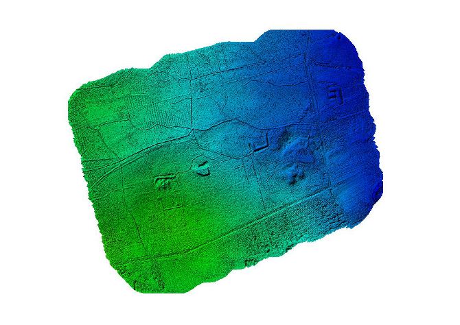
Complete terrain topography
Do you want to know what secrets are hiding your forest? We generate a digital field model allowing to have a clear and precise topography of the soil. This model can be used in particular to determine the skidding roads or to understand the flow of water.
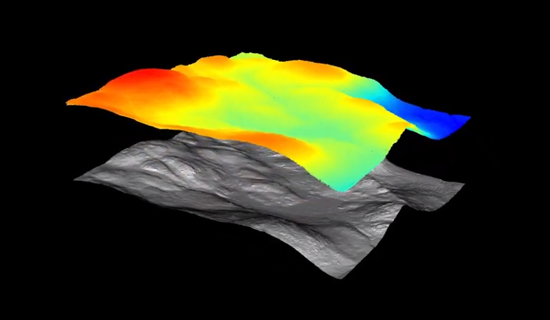
Subtraction of the digital field model
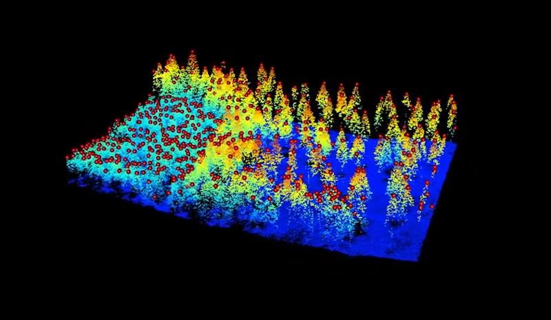
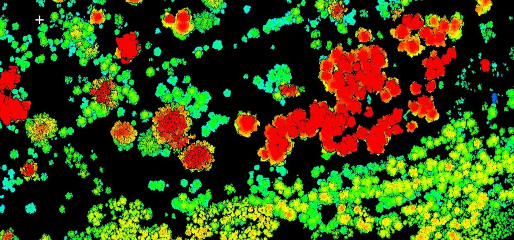
CIME detection
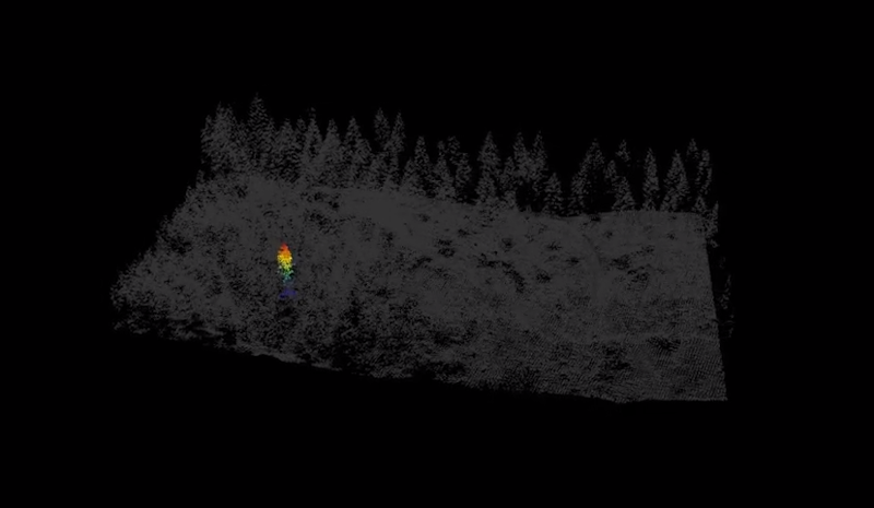
Extraction of individual trees
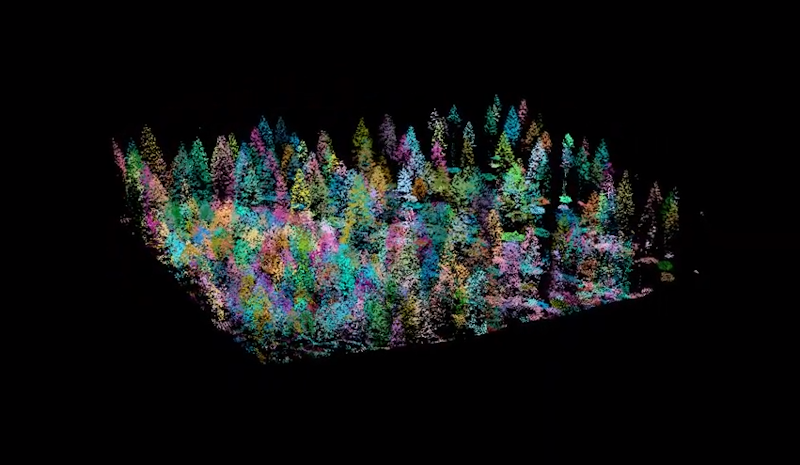
Trees segmentation
Digital settlement model
Tower treatment for supermarkets
Contact us now
A project to be carried out? We answer you during the day!
A question?Contact our experts
What is the difference between photogrammetry and lasergrammmetry?
Photogrammetry is based on photographs taken at different angles in order to rebuild a 3D model while lasergrammmetry is based on the laser principle in order to determine the position of the points in space and thus model a whole 3D cloud.
What is a slopes card?
A slope card is a matrix file (raster) which provides real digital values representing slopes. This product is generated from the digital field model. The map of slopes is useful as support for forest operations or the construction of roads and trails (e.g. trace practicable emptying routes).
In what cases in what cases use a drone equipped with a lidar?
The airborne Lidar will be very effective in modeling the levels of a terrain covered with vegetation. This technique is widely used in forestry, hydrology, spatial planning or even to do archaeological research.
What is a MHC?
The canopy height model (MHC) is a matrix file (raster) which provides digital values representing the height of the forest canopy or other raised elements (eg, buildings). This product corresponds to the difference between the digital surface model and the digital field model. The MHC allows measures of height, density and structure of the stands. It can make it possible to establish statistical relationships to map volumes, terrified surfaces, etc.