Objective of the airborne lidar survey in the forest
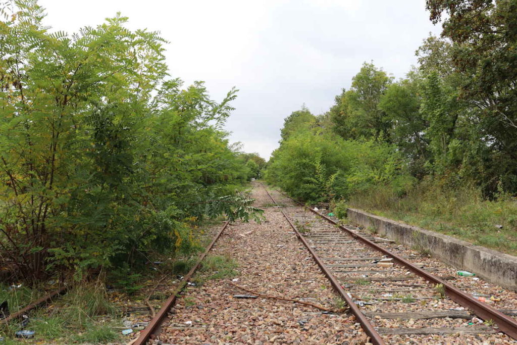
The objective was to produce a digital terrain model (DTM) of 3 km of disused railway track for its renovation. The railway track being surrounded by trees, the interest of the lidar for this mission was to be able to benefit from the precision of the laser in order to cross the vegetation and thus to obtain a cloud of points with also points at the level of the floor.
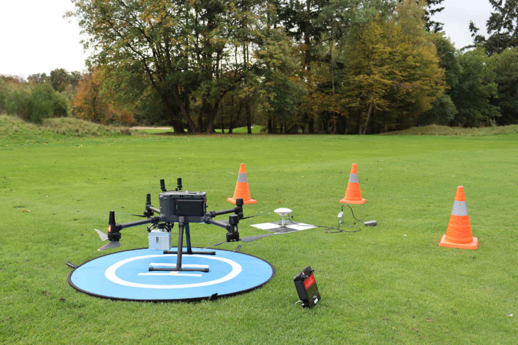
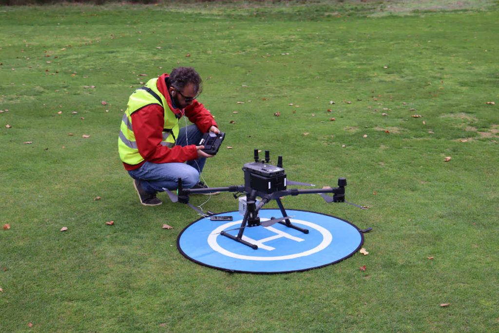
A DJI Matrice 300 drone equipped with a GreenValley Liair V lidar
A team of three people: a remote pilot, a remote pilot assistant and a topographer. We used a DJI Matrice 300 drone equipped with Liair V lidar from GreenValley, a benchmark in lidar. The autonomy of the Matrice 300 makes it possible to carry out long flights and to fly in the event of strong wind. The Liair V lidar can scan 100,000 points per second with 3 echoes.
Overflight permissions
We had to obtain waivers from a nearby airfield and helipad so that we could fly at a height of 80m. We also asked for authorization from the prefecture because part of the route was located in a built-up area, as well as authorization for the private land from which we took off and landed.
Flight planning
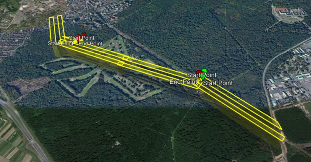
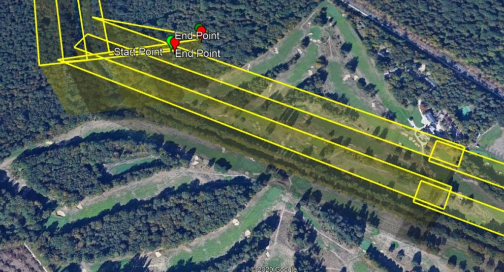
4 flights covered a strip about 3 km long and 100 m wide. Flights with lidar capture must follow straight trajectories with enough overlap to ensure optimal acquisition. Flight plans are systematically studied and developed upstream using Litchi, a flight planning application for drones.However, for the moment, flight planning applications are not entirely adapted to capture by lidar and the calculation of the parameters must be carried out manually so that all the values are coherent and adapted to the mission: flight height, overlap between the bands, width, length and angle of the trajectories.
The mission field
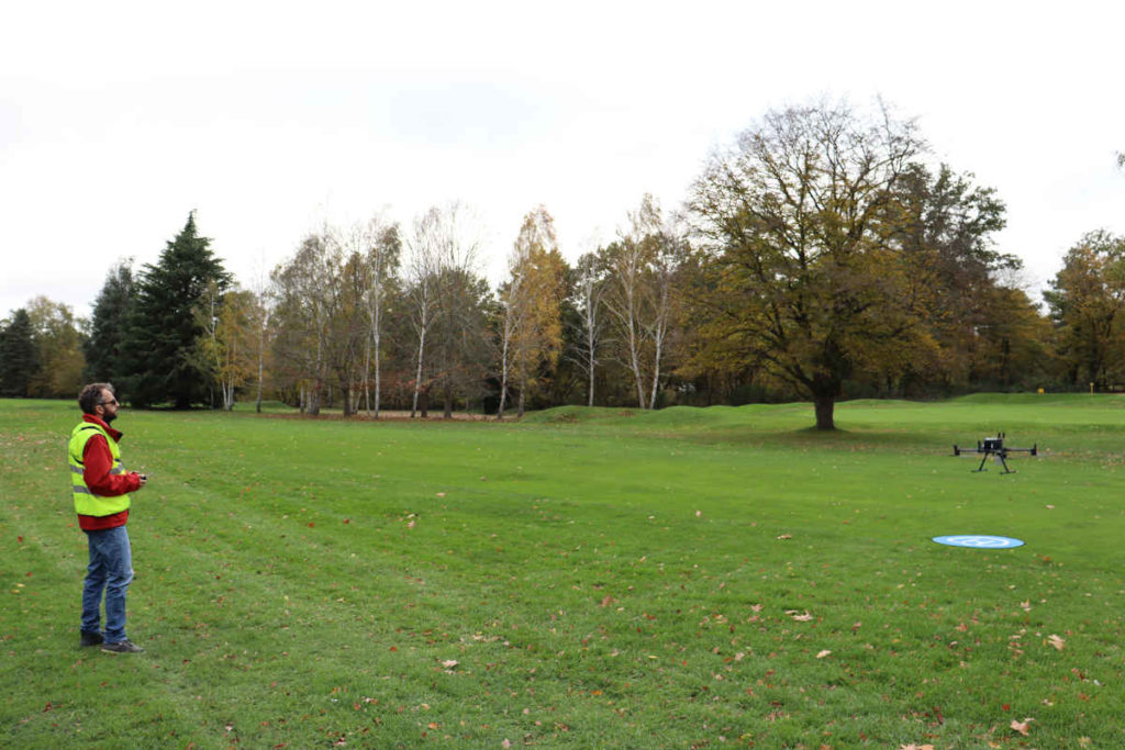
The goal was to fly over disused railway tracks surrounded by trees for a distance of 3 km. Unfortunately the configuration of the land did not allow to take off from the tracks in complete safety, on the one hand because the obstruction of the trees around was too important and on the other hand because the metal rails confused the compass of the drone. However, a nearby golf course allowed us to take off from their land.
the flights
Although we had initially planned one day to carry out all the flights, the inclement weather that day forced us to interrupt the mission at the beginning of the afternoon. The flights were thus able to be carried out over two days.The start-up time of the equipment, necessary to obtain a good satellite acquisition, imposes a duration of approximately one hour for a flight. In addition, the size of the equipment and the travel times on the site also add approximately one hour to the completion of a flight. So even if a flight lasts only 15 minutes, it takes almost 2 hours of effective time for its realization.
Production of a digital terrain model
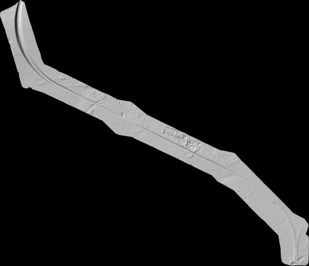
The post-processing of the data consisted in particular in the production of a cloud of points, a digital terrain model (DTM) with a mesh of 50 cm and a shaded DTM. The digital terrain model is a model representing the altimetry of the ground. The shaded DEM, seen below, helps to make the relief stand out.The advantage of lidar, for soils comprising dense vegetation such as a forest, is to be able to penetrate this vegetation in order to obtain points on the surface of the ground. The software also allows us to categorize the points representing trees and eliminate them from our model in order to keep only the points on the ground. This model then makes it possible to carry out field studies and simulations in order to undertake construction work.
About The Author: Admin
More posts byadmin